
The Archive as Infrastructure
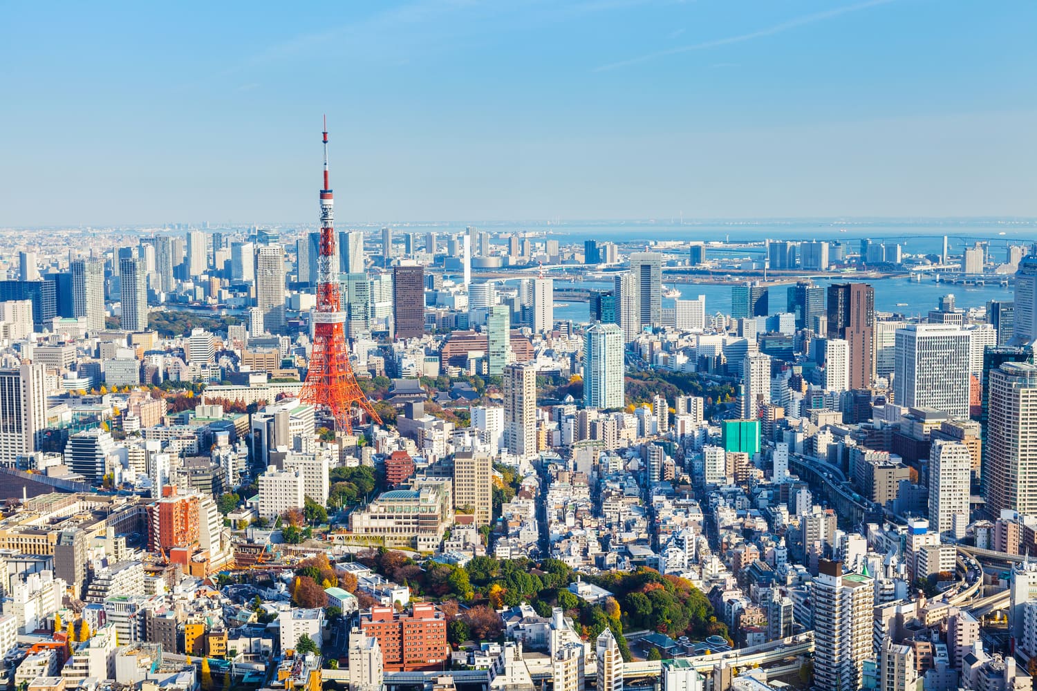
At World Archi Design, we've been tracking a quiet revolution in how governments think about spatial data. Japan's PLATEAU initiative, steered by the Ministry of Land, Infrastructure, Transport and Tourism, now offers open-access digital twins of more than 250 cities, a figure that represents roughly a third of the nation's 744 municipalities. The models span metropolises with populations exceeding one million and smaller settlements hovering around 10,000 residents, each rendered in three dimensions and structured with semantic metadata that goes far beyond shape.
What distinguishes PLATEAU from earlier mapping efforts is its deliberate framing as platform infrastructure rather than static archive. The project does not simply catalog urban form; it offers a substrate on which architects, planners, and technologists can layer analysis, simulation, and intervention. In this sense, PLATEAU is less a dataset and more an environment, a shift that mirrors the evolution of design software from tool to ecosystem.
From Fragments to Federation
The technical ambition behind PLATEAU lies in its method of assembly. Rather than commissioning bespoke surveys for each municipality, the initiative aggregates existing resources held by local governments: GIS layers, survey reports, point cloud scans, and cadastral records. This "unearthing" strategy, as the program describes it, levels access to data that was previously siloed within individual administrative units. The result is a federated model that scales without proportional cost increases, a crucial consideration for a program targeting 500 cities by 2027.
The models adhere to CityGML, an international standard maintained by the Open Geospatial Consortium. Unlike conventional 3D representations that capture only geometry, CityGML encodes semantic attributes: year of construction, building usage, planning designations, and structural typologies. This enrichment transforms the models into queryable databases, enabling cross-sectional analysis that would be impractical with traditional CAD files or polygon meshes.
In March 2021, PLATEAU introduced Japan's first unified specification for 3D city models, a framework now in its fifth iteration. The standardization addresses a perennial challenge in multi-jurisdictional data projects: ensuring interoperability across software platforms and municipal boundaries. By codifying formats, quality thresholds, and metadata schemas, the specification allows models produced in Nagoya to integrate seamlessly with those from Osaka or Tokyo.
Use Cases Across Scales
The applications outlined by PLATEAU's architects span disciplines and timescales. Urban planners can simulate pedestrian flows and test zoning scenarios; disaster management teams can model flood inundation and evacuation routes; environmental engineers can analyze solar exposure, urban heat island effects, and wind patterns at building resolution. The models also support mobility planning, including route optimization for autonomous vehicles, and infrastructure monitoring through the integration of sensor data and point cloud analysis.
For architects, the platform offers a form of context modeling that bypasses the labor-intensive process of site documentation. Rather than reconstructing massing and topography from scratch, a practice can download a district model, overlay proposed interventions, and conduct shadow studies or sightline analyses within hours. This efficiency is particularly valuable in dense urban cores, where adjacency relationships and cumulative impact are as critical as the design of individual buildings.
PLATEAU has also ventured into preservation. A digital reconstruction of the recently concluded 2025 Osaka World Expo site, including Sou Fujimoto's timber Grand Ring and pavilions from participating nations, is now accessible through the platform. The model was assembled using BIM data and point cloud scans, capturing a temporary architectural landscape that would otherwise exist only in photographs and documentation drawings. The act of archiving an ephemeral exhibition within a permanent urban data infrastructure raises questions about what we choose to preserve and how digital twins might serve collective memory alongside operational utility.
Standardization and Its Discontents
The push for standardization brings both clarity and constraint. On one hand, unified specifications enable cross-platform workflows and reduce the friction of data exchange. On the other, they impose a flattening logic that may obscure local particularities or unconventional typologies. A standardized building category, for instance, must accommodate both the machiya of Kyoto and the modernist towers of Shinjuku, a taxonomic challenge that risks either oversimplification or unwieldy granularity.
The CityGML standard itself has evolved to address these tensions, introducing levels of detail (LOD) that range from simple extrusions to fully articulated facades with window and door geometries. PLATEAU's models typically operate at LOD2 or LOD3, a middle ground that balances visual fidelity with file size and processing demands. For many applications, this resolution suffices; for others, particularly those requiring facade-level detail or interior spatial analysis, the models serve as starting points rather than finished products.
The platform's reliance on existing municipal data also introduces variability in quality and completeness. Older surveys may lack precision; smaller municipalities may have sparser records. PLATEAU's aggregation strategy mitigates cost but inherits the inconsistencies of its source material, a trade-off that users must navigate when conducting rigorous analysis.
The Open Data Imperative
PLATEAU's commitment to open access distinguishes it from proprietary urban modeling efforts. The models are distributed through Japan's G-Spatial Information Center and can be previewed via PLATEAU VIEW, a browser-based interface that allows users to navigate cities, toggle data layers, and export geometries without specialized software. This accessibility lowers barriers for researchers, students, and smaller practices that lack enterprise GIS licenses or high-performance computing infrastructure.
The open data model also invites experimentation. By making the platform legible to developers outside government, PLATEAU enables third-party applications that its architects may not have envisioned. A recent wave of tools from architecture practices, Henning Larsen's OpenDetail database of construction details, Grimshaw's Minoro carbon tracking system, and MVRDV's CarbonSpace accounting platform, suggests a broader trend toward open-source knowledge infrastructure in the built environment. PLATEAU operates at a different scale but shares the logic: data becomes more valuable when it circulates.
Precedents and Parallels
Japan is not alone in pursuing national-scale digital twins. Singapore's Virtual Singapore project, launched in 2014, similarly aggregates 3D city models with real-time sensor data for planning and simulation. The Netherlands' 3D Basisvoorziening aims to model the entire country at building resolution. What sets PLATEAU apart is its emphasis on reuse and federation, an approach that may prove more replicable for countries with decentralized governance structures or limited budgets for new data collection.
The project also resonates with earlier efforts to standardize architectural knowledge. The modular coordination systems of the postwar period, Konrad Wachsmann's industrialized building components, or the dimensional standards promoted by ISO, sought to rationalize construction through shared conventions. PLATEAU applies this logic to data rather than materials, proposing that interoperable information is as foundational to contemporary practice as standardized bricks or steel sections once were.
The Environment, Not the Tool
Software has shifted from being a discrete instrument to an ambient condition of architectural work. We model, analyze, document, and communicate within digital environments that structure not only what we produce but how we think. PLATEAU extends this environment beyond the boundaries of individual projects, offering a shared spatial context that architects can inhabit, interrogate, and modify.
The implications are subtle but far-reaching. A digital twin library does not dictate design outcomes, but it shapes the questions architects can ask and the speed at which they can answer them. It normalizes certain forms of analysis, solar studies, flood risk assessments, pedestrian simulations, while leaving others, social dynamics, informal uses, sensory qualities, outside its frame. The challenge for practitioners is to use these tools critically, recognizing both their affordances and their blind spots.
As PLATEAU expands toward its 500-city target, it will test whether open data infrastructure can sustain itself beyond initial government funding. The success of such platforms depends not only on technical robustness but on the communities that adopt, adapt, and extend them. If architects, planners, and researchers find ways to fold PLATEAU into their workflows, contributing improvements and surfacing new applications, the project may prove durable. If it remains a top-down repository, its utility will plateau long before reaching 500 cities.
Save this story. A free account keeps your reading list and the 07:00 email in one place.
CREATE FREE ACCOUNT →SIGN IN