
A Settlement Built on Displacement
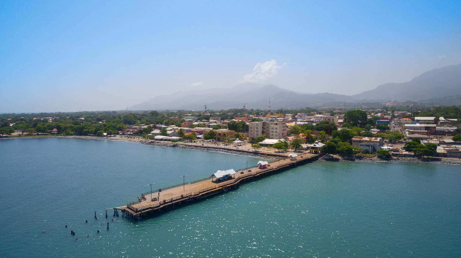
The city of La Ceiba sits on a narrow coastal strip in Honduras, pressed between the Caribbean Sea and the Nombre de Dios Mountain Range. For most of the colonial period, this stretch of the Leán Valley remained frontier territory: jungle, swamp, and inhospitable terrain that deterred permanent settlement. That changed at the turn of the nineteenth century, when the Garífuna arrived.
The Garífuna are descendants of West African and Indigenous Carib communities, exiled by British authorities from Saint Vincent to Roatán in 1797. Spanish colonial officials later negotiated their resettlement on the Honduran mainland near Trujillo. Around 1810, a subset of this population moved westward into the Leán Valley and established a small fishing village called La Barra, near the mouth of the Cangrejal River. The site offered access to both inland waterways and maritime trade routes, a geographic advantage the Garífuna exploited to link forest resources with regional port economies.
La Barra's founding represents more than a demographic footnote. It introduced a coastal settlement pattern fundamentally different from Spanish colonial urbanism: low-density, water-oriented, and embedded in trade networks that bypassed the interior altogether. The architecture reflected this logic. Traditional Garífuna dwellings used timber frames, thatched roofs, and elevated foundations to manage humidity and ventilation. These structures prioritized adaptability over permanence, a tectonic approach suited to a community defined by forced mobility.
Dual Nuclei and Inland Arrivals
Word of fertile land and economic opportunity traveled inland by the 1830s, triggering the second major migration wave. Families from the departments of Olancho and Yoro made the journey, some by coastal routes via Trujillo, others overland through mountain passes. Around 1835, Pech families, an Indigenous group from Olancho, also arrived. Unable to secure land in La Barra due to competition with established Garífuna and inland settlers, they founded a separate nucleus near a large ceiba tree several kilometers away.
By 1840, urban growth had connected these two settlements, producing a dual structure: the original Garífuna village at La Barra and a second node around the ceiba tree, which eventually gave the city its name. This was not yet a unified municipality. La Ceiba functioned as a loose confederation of adjacent neighborhoods linked by commerce and labor exchange, each retaining distinct spatial and cultural characteristics.
The dual-nucleus morphology is significant. It suggests that La Ceiba's urbanism was less about centralized planning and more about the accretion of migration-driven settlements. The city grew not from a single colonial plaza outward, but from multiple points of arrival, each anchored by a different community's relationship to the landscape.
Corporate Intervention and the Railroad
The 1860s brought banana cultivation to the Honduran Caribbean coast. The Leán Valley's river systems allowed small farmers to float their harvest downstream to waiting ships, transforming La Ceiba into a de facto export hub. This attracted another migration wave, this time from Europe, the Middle East, and North America, drawn by the promise of agricultural profit.
But it was the arrival of large US corporations that fundamentally reorganized the city's spatial logic. In 1899, the Vaccaro Brothers company from New Orleans established operations in La Ceiba. Through concessions granted by Honduran president Manuel Bonilla, the company expanded railroad infrastructure along the Caribbean coast and formalized banana export operations. The Vaccaro Brothers eventually became the Standard Fruit and Steamship Company, which, alongside the United Fruit Company in nearby Tela, dominated the region's economy for decades.
Standard Fruit did not simply operate within La Ceiba; it produced a parallel urban system. The clearest example is Mazapán, a company-controlled enclave west of the city center. Mazapán contained worker housing, schools, warehouses, workshops, and a dedicated railway terminal. Its layout followed corporate efficiency principles rather than local settlement patterns. The result was a spatial bifurcation: corporate infrastructure on one side, existing urban life on the other.
This intervention redirected urban expansion. New plazas and arterial roads, including Avenida San Isidro and Avenida La República, followed rail lines rather than organic growth patterns. The railroad became the city's primary organizing axis, a shift that subordinated local spatial logic to export-oriented infrastructure.
Architectural Imports and Fire Cycles
Corporate presence also reshaped the built environment. Plantation-style architecture imported from the southern United States became dominant: timber-frame construction, zinc roofing, elevated ventilation, and wide verandas designed for tropical heat and humidity. This created a Caribbean-coastal architectural language distinct from the masonry-based urbanism of inland Honduran cities like Tegucigalpa. The divergence was not merely aesthetic. It represented two parallel national identities developing under different external influences.
Yet timber construction carried inherent risks. Major fires, particularly in 1924, repeatedly destroyed large sections of the urban core. These cycles of destruction and reconstruction gradually shifted building practices toward concrete. The municipal building near the central park, constructed in the 1930s, exemplifies this transition.
The fire cycles also reveal something about La Ceiba's urban resilience. Rather than abandoning the city after repeated disasters, residents rebuilt, often incorporating new materials and techniques. This iterative process of destruction and adaptation contributed to the city's architectural layering, where different construction eras coexist within a single urban fabric.
Labor Importation and the Barrio Inglés
Standard Fruit's labor needs triggered another migration wave. Seeking cheaper workers and operational efficiency, the company recruited from British Caribbean colonies including Belize, Jamaica, Trinidad and Tobago, and Saint Vincent. This influx consolidated a neighborhood known today as the Barrio Inglés, or English Town, embedding a multicultural Caribbean diaspora into the urban fabric.
The Barrio Inglés is significant not only for its demographic composition but for its spatial character. It functioned as an intermediary zone between the Garífuna-influenced coastal settlements and the corporate enclave of Mazapán. The neighborhood's architecture blended vernacular Caribbean building traditions with the imported plantation style favored by the fruit companies, producing a hybrid typology that reflected the layered origins of its residents.
At its economic peak, La Ceiba hosted major banking institutions with authority to issue currency. Yet the city remained geographically isolated from the national road network until 1965, when the CA-13 highway finally connected it to the rest of Honduras. Until then, access depended on railway lines controlled by banana companies, a condition that reinforced the city's economic dependence on export agriculture.
Contemporary Traces and Spatial Logic
In its current form, La Ceiba's urban structure still reflects the forces that shaped it. The CA-13 corridor produces linear expansion along the coastline, while the historic center retains administrative and commercial concentration. Former port areas have been converted into public spaces, and remnants of the banana era persist in urban parks and spatial patterns.
The city's identity is stratified, produced by the continuous circulation of people, goods, and economic power over more than two centuries. Each migration wave did not simply add population; it reorganized space, introduced new building typologies, and redirected infrastructure. The result is an urbanism that cannot be attributed to a single planning vision or cultural tradition. La Ceiba is instead a composite, a city where displacement, adaptation, labor importation, and capital movement have layered into a single, complex spatial reality.
At World Archi Design, we have long argued that migration is not an external force acting on cities but a constitutive one. La Ceiba offers a clear case study. Its dual nuclei, corporate enclaves, fire-driven material transitions, and hybrid architectural languages all emerge from the movement of people across borders, whether forced, recruited, or voluntary. The city's form is inseparable from its history of migration, and its architecture is a record of who arrived, when, and under what conditions. Understanding La Ceiba means understanding how movement produces space.
Photo: Shutterstock
Save this story. A free account keeps your reading list and the 07:00 email in one place.
CREATE FREE ACCOUNT →SIGN IN