
A Question of Continuity
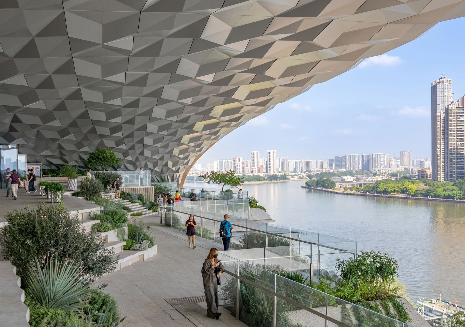
Urban waterfronts in dense Asian cities have long oscillated between two extremes: either fortified infrastructure that severs the city from the river, or manicured parks that feel detached from the urban grain. Bai'etan, a ten-hectare public landscape completed in 2026 along the Pearl River in Guangzhou, proposes a third condition. Designed by UTE Agence Ter in collaboration with Ana Coello de Llobet, the project employs a continuous, multi-level topography to reconnect historic neighbourhoods with the water, dissolving the typical boundary between riverfront promenade and city fabric.
The approach recalls Adriaan Geuze's work on Rotterdam's Maas Boulevard, where landform itself becomes the organising device. Here, the gesture is less about spectacle and more about threading together disparate urban conditions: heritage quarters, contemporary commercial strips, and the infrastructural edge of the river. The result is a public realm that functions as both circulation and destination, where the act of moving through the site becomes inseparable from the experience of place.
Topographic Strategy and Sectional Complexity
Rather than impose a singular datum, the design works with elevation as a spatial tool. The landscape rises and falls across the site, creating a series of interconnected plateaus, ramps, and terraces that negotiate the natural flood plain and the elevated embankment. This sectional complexity allows the project to accommodate multiple programmes, from shaded gathering spaces beneath planted canopies to open plazas that extend views toward the river.
The topographic manipulation is subtle but deliberate. Gentle slopes replace stairs wherever possible, ensuring accessibility while maintaining a sense of continuity. Where level changes are unavoidable, they are integrated into seating walls or planted berms, avoiding the visual and experiential rupture of conventional staircases. The effect is a landscape that feels less designed than discovered, a quality that invites prolonged inhabitation rather than quick passage.
This approach also addresses flood management without resorting to visible barriers. By modelling the terrain to absorb seasonal water-level fluctuations, the design integrates resilience into its formal language. The strategy is pragmatic, yet it avoids the aesthetic of engineered defence that characterises many urban riverfronts.
Material Palette and Planting Structure
The material vocabulary is restrained, relying on local stone, permeable paving, and a carefully calibrated planting scheme. Granite slabs in varying widths define circulation routes, their rhythm shifting to indicate changes in pace or programme. Permeable surfaces dominate, reducing runoff and mitigating heat island effects in a city where summer temperatures routinely exceed thirty-five degrees Celsius.
Planting is deployed strategically, not as ornament but as spatial structure. Rows of native trees, including Ficus microcarpa and Cinnamomum camphora, provide shade and frame sightlines. Ground-level vegetation is massed to create enclosure without blocking views, a balance that requires precise species selection and maintenance regimes. The planting plan acknowledges the subtropical climate, favouring drought-tolerant species that can withstand both seasonal monsoons and extended dry periods.
The relationship between hard and soft landscape is calibrated to shift across the site. In areas adjacent to historic neighbourhoods, planting is denser, creating a buffer that mediates between the intimate scale of traditional streets and the expansive riverfront. Closer to the water, the landscape opens up, allowing unobstructed views and wind circulation.
Urbanism and Everyday Use
Bai'etan's success will ultimately be measured not by formal innovation but by how it supports daily life. The design accommodates a range of activities: informal markets, tai chi practice, children's play, and evening promenades. These uses are anticipated but not prescribed, a distinction that requires confidence in the flexibility of the spatial framework.
The project also recalibrates the relationship between Guangzhou's historic core and its modern commercial districts. By providing a continuous pedestrian route that links previously fragmented neighbourhoods, it encourages movement patterns that bypass congested arterial roads. This connectivity is reinforced by integration with the city's metro system and bicycle infrastructure, ensuring that the site functions as a genuine public resource rather than a destination park.
One precedent worth noting is Turenscape's Qunli Stormwater Park in Harbin, which similarly uses landform to integrate ecological performance with public access. Bai'etan differs in its urban density and the intensity of its programmatic demands, yet both projects demonstrate that landscape architecture in contemporary China is increasingly concerned with synthesis, weaving together ecological, social, and infrastructural imperatives.
A Model for Incremental Urbanism
What distinguishes Bai'etan from many large-scale public projects is its avoidance of singular iconic gestures. There is no landmark pavilion, no sculptural folly. Instead, the design operates through accumulation, a series of modest interventions that collectively transform the character of the riverfront. This restraint is unusual in a context where public projects often serve as branding exercises for municipalities and developers.
The question remains whether this model can endure. Public landscapes in rapidly developing cities face constant pressure from adjacent development, shifting political priorities, and inadequate maintenance budgets. Bai'etan's long-term viability will depend on sustained stewardship and protection from incremental privatisation.
For now, the project offers a compelling demonstration that urban waterfronts need not choose between infrastructure and amenity. By treating topography as a continuous field rather than a series of discrete interventions, it creates a public realm that is both pragmatic and generous, a condition that remains rare in cities of Guangzhou's scale and density.
Save this story. A free account keeps your reading list and the 07:00 email in one place.
CREATE FREE ACCOUNT →SIGN IN