

The Toolkit Illusion
Across the projects we've covered this year, a pattern emerges: municipalities catalog their climate interventions like items on a shopping list. Green roofs tally up by square meter, tree canopy by percentage gain, bioswales by linear footage installed. The reporting is precise, the ambition genuine, yet something fundamental goes missing in translation. These elements are treated as discrete additions to the urban fabric, nature-based solutions dropped into neighborhoods like furniture into rooms, valued for their individual performance metrics rather than their participation in a larger system.
The language itself reveals the conceptual frame. "Green infrastructure" becomes shorthand for vegetated surfaces, "blue infrastructure" for anything involving water bodies - rivers, wetlands, restored coastlines, canal networks. The taxonomy is tidy, useful for budgeting and procurement, but it assigns water to a subcategory when hydrology actually operates as the governing framework. A bioswale does not function because it contains plants; it functions because it redirects, slows, and infiltrates water, which in turn determines which plants survive, how soil biology develops, and whether the intervention performs under stress. The water is not the object. The water is the system.
What Hydrology Actually Organizes
Consider the mechanics. Vegetation establishes where water tables, drainage patterns, and seasonal flooding create viable conditions. Ecosystems develop along gradients of moisture, salinity, and inundation frequency. Floodplains absorb surge not because they are open space but because their topography, soil permeability, and connectivity to waterways allow them to hold and release flows over time. Groundwater recharge sustains landscapes through drought, feeds springs and baseflow, and moderates urban heat islands by maintaining subsurface moisture that cools from below.
None of these processes operate in isolation. A city might install two hundred rain gardens and protect a dozen wetland fragments, meeting every line item in its adaptation plan, yet if those interventions are not hydrologically connected - if stormwater still channels into sealed pipes, if groundwater extraction continues unchecked, if upstream land use sends contaminated runoff through restored riparian corridors - the system fails to cohere. The parts perform, but the whole does not.
This is not a minor oversight. At World Archi Design, we have tracked projects where beautifully detailed green infrastructure withers within two growing seasons because designers did not map subsurface hydrology, where restored wetlands become maintenance liabilities because they were sited without understanding seasonal water budgets, where tree canopy expansion targets collide with irrigation constraints because no one coordinated planting zones with aquifer recharge areas. The interventions were competent in isolation. The failure was systemic.
The Precedent We Keep Ignoring
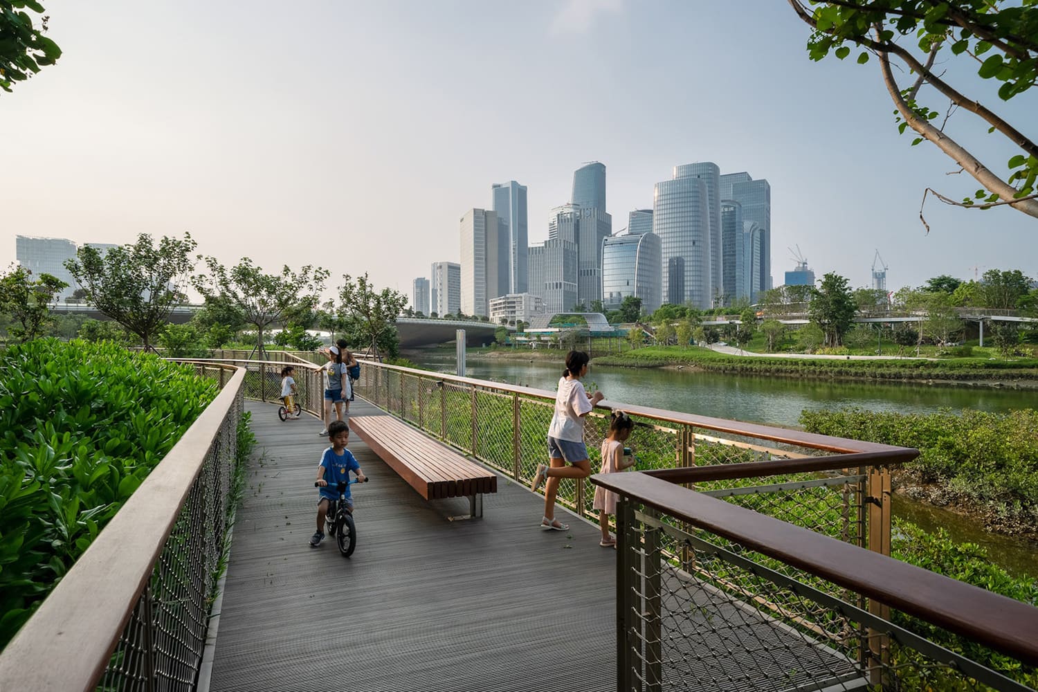
Landscape urbanism spent two decades arguing that infrastructure and ecology are inseparable, that the performance of urban systems depends on understanding flows - material, hydrological, biological - as the medium through which cities operate. Projects like Qianhai's Guiwan Park by Field Operations or the Toronto waterfront revitalization demonstrated that when water is treated as the organizing logic, the resulting landscapes do more than mitigate flood risk: they structure public space, generate habitat corridors, improve water quality, and create recreational amenity as byproducts of hydrological function.
Yet the lesson has not transferred to policy. Adaptation plans still parse interventions by type - green, blue, gray - rather than by the systems they participate in. Funding streams remain siloed between stormwater management, parks departments, and environmental restoration programs. Designers are hired to solve site-specific problems without access to watershed-scale data. The result is a patchwork of well-intentioned projects that do not accumulate into resilience.
Reframing the Conversation
Recognizing water as system rather than component requires a shift in how we scope, fund, and evaluate urban climate work. It means mapping hydrological networks before designating intervention sites, understanding that a rain garden in one neighborhood affects groundwater recharge three kilometers away, that upstream canopy loss changes downstream flood timing, that restoring wetlands without addressing their water sources produces ornamental landscapes, not functional ecosystems.
It also means rethinking professional boundaries. Hydrologists, ecologists, and urban designers need to work from the same base maps, using shared models of how water moves through the city seasonally, annually, and under climate stress. Engineers accustomed to controlling flows with pipes and pumps must collaborate with landscape architects who understand that slowing and dispersing water can be more effective than channeling it. Planners must recognize that land use decisions - where density concentrates, where surfaces are sealed, where canopy is preserved - are hydrological decisions, whether they acknowledge them as such or not.
The technical capacity exists. Watershed modeling tools, real-time sensor networks, and predictive hydrology are standard practice in water management. The gap is conceptual: integrating those tools into the design and planning processes that shape cities, rather than treating hydrology as a constraint to be managed after spatial decisions have been made.
What Coordination Looks Like
A coordinated approach does not require abandoning nature-based solutions. It requires deploying them as part of a hydrological strategy. Green roofs reduce runoff peaks, but their impact multiplies when paired with street-level infiltration systems that capture and store the water they release. Urban forests cool neighborhoods, but their survival depends on maintaining groundwater levels through regional recharge zones. Protected wetlands buffer storm surge, but their ecological health depends on upstream land use that preserves water quality and flow regimes.
This is not a call for centralized control or megaprojects. Distributed interventions work, but they must be hydrologically literate - sited, scaled, and connected in ways that recognize water as the medium through which they function. A city that understands this does not need to redesign its entire watershed at once. It needs to ensure that each project, however modest, contributes to a coherent hydrological logic rather than fragmenting it further.
The Cost of Misreading
The consequences of treating water as a component rather than a system are already visible. Cities invest heavily in green infrastructure only to see performance decline as groundwater tables drop. Coastal restoration projects fail because they address sea-level rise without accounting for changes in inland hydrology that alter sediment supply and salinity gradients. Neighborhoods celebrate new parks while adjacent areas flood more severely because stormwater was redirected without regional coordination.
These are not failures of ambition or technical skill. They are failures of framework. Until water is understood as the organizing system through which ecological and infrastructural processes operate, nature-based solutions will remain a collection of well-designed parts that do not add up to resilience. The question is not whether cities should invest in green and blue infrastructure. The question is whether they will learn to see the water first.
Save this story. A free account keeps your reading list and the 07:00 email in one place.
CREATE FREE ACCOUNT →SIGN IN