
A Different Framework for Urban Life
The assumption that streets form the skeleton of cities runs deep in architectural education. We teach massing studies that respond to street grids, analyze façade compositions oriented toward sidewalks, and diagram circulation patterns that presume wheeled vehicles. This framework feels universal until you examine settlements where it never applied. In several Southeast Asian port cities, the organizing logic was fundamentally aquatic. Boats served as the dominant mode of transit, commerce transpired along riverbanks, and architectural frontages addressed water rather than pavement. The implications for spatial design were profound.
At World Archi Design, we've been tracking how infrastructure choices encode themselves into built form. The relationship between transportation networks and architectural typology is rarely neutral. When the primary means of movement shifts from watercraft to automobiles, the entire hierarchy of urban space reconfigures itself. Examining cities that developed around navigable channels rather than roadways offers a lens into how infrastructure and architecture co-evolve, and how different systems of movement produce different spatial priorities.
The Hydraulic City as Prototype
Hội An, positioned along the Thu Bồn River in what is now central Vietnam, offers a remarkably preserved example of this alternative urbanism. During its peak as a trading hub between the sixteenth and nineteenth centuries, the city's prosperity depended entirely on maritime exchange. Merchant houses, guild halls, storage warehouses, and market structures clustered directly along the riverbank. Property values correlated with proximity to navigable water. Buildings were designed with their primary entrances facing the river, where vessels docked to load silk, ceramics, and spices bound for regional and international markets.
UNESCO documentation of Hội An's historic quarter reveals an urban fabric in which river access determined spatial hierarchy. The most prominent structures occupied prime waterfront positions, while secondary streets developed perpendicular to the river rather than parallel to it. This orientation reflects a fundamental principle: in hydraulic cities, water functions as the main artery, and land-based routes serve as connectors to that central spine. The result is an inverted relationship compared to automobile-oriented planning, where arterial roads form the primary structure and other elements branch outward.
Architectural Consequences of Aquatic Movement
When the majority of urban inhabitants arrive by boat, architecture must respond differently. The threshold between water and building becomes the most active interface, a zone of constant negotiation between fluid and fixed elements. In road-based urbanism, this role is performed by the sidewalk and storefront; in river cities, docks, piers, and floating platforms assume equivalent functions. The architectural language adapts accordingly.
Consider the traditional shophouse typology common throughout Southeast Asia. In terrestrial versions, the ground floor opens toward the street, with living quarters stacked above. River-oriented variants position the main commercial zone at the water's edge, often extending outward on stilts or pontoons to maximize frontage. Storage areas occupy the rear, closer to land. This reversal isn't merely cosmetic; it reflects a different conception of public versus private space, of front versus back, of access versus service.
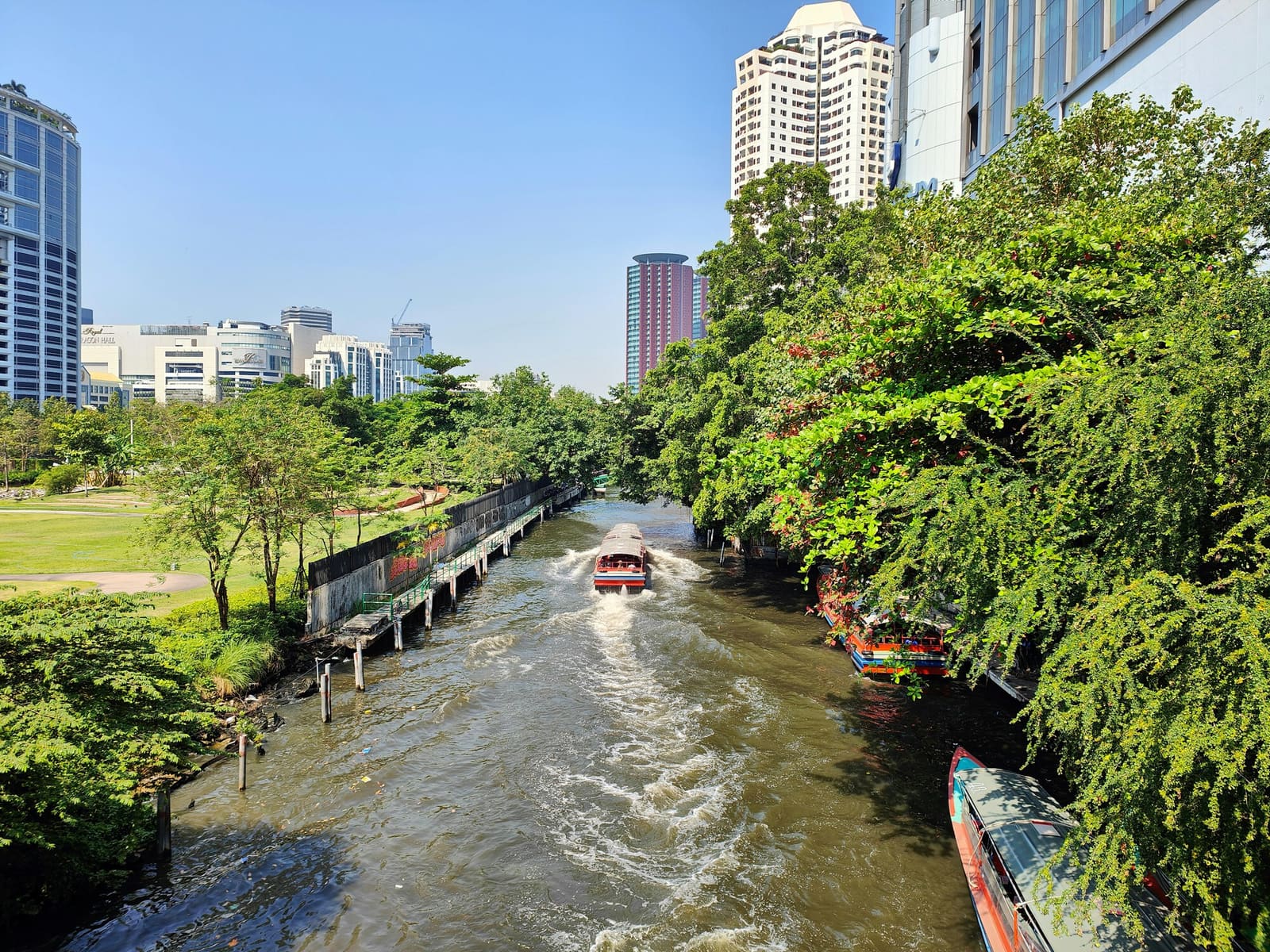
Bangkok's historic canal network, known locally as khlongs, demonstrates this principle at metropolitan scale. Before the twentieth-century expansion of paved roads, the city functioned as an intricate web of natural and artificial waterways. Residential compounds, Buddhist temples, royal palaces, and commercial districts all oriented their primary façades toward canals. Ceremonial processions traveled by royal barge, daily provisions arrived via vendor boats, and neighborhood identity was defined by which canal you lived along. The khlong edge served simultaneously as street, plaza, and marketplace.
Urban historian Marc Askew has documented how this morphology created a settlement pattern inseparable from its hydraulic infrastructure. Buildings didn't simply sit near water; they were designed as architectural responses to an aquatic transportation system. Stilts allowed structures to rise and fall with seasonal flooding. Overhanging eaves provided shelter for boats moored below. Terraces and balconies extended toward the canal rather than retreating from it, functioning as semi-public zones where transactions occurred and social life unfolded.
Material and Tectonic Adaptation
Palembang, located along the Musi River in southern Sumatra, evolved under similar conditions. The city's traditional neighborhoods featured timber houses raised on piles or constructed on floating platforms. This wasn't merely a response to flood risk; it was an integrated approach to living within a dynamic hydrological system. Seasonal water level variations could exceed several meters, making fixed foundations impractical. Instead, architecture incorporated mobility and flexibility as design parameters.
The construction techniques reflect this reality. Post-and-beam timber frames allowed for disassembly and relocation. Lightweight cladding materials could be easily replaced after storm damage. Floating structures were tethered to allow vertical movement while maintaining position. These weren't provisional or informal solutions; they represented a sophisticated understanding of how to build permanent settlements within unstable environments. The architecture treated water not as a hazard to be engineered away, but as a condition to be accommodated through design.
Jetties and piers functioned as extensions of domestic space, serving as outdoor rooms where washing, food preparation, and social gathering occurred. Commercial exchange happened directly from boat to dock, eliminating the need for land-based market structures. The line between building and infrastructure blurred considerably. A pier could be simultaneously a circulation path, a commercial platform, a social gathering spot, and an architectural element. This multiplicity of function contrasts sharply with the specialization typical of automobile-oriented development, where parking structures, retail buildings, and transportation corridors occupy distinct zones.
The Road Takes Over
The transition from water-based to road-based urbanism didn't occur overnight, but its architectural consequences were systematic. During the colonial period and continuing through the twentieth century, investment shifted decisively toward paved streets and automobile infrastructure. In Bangkok, this meant the progressive filling of canals to create roadbeds. Bridges replaced ferry crossings, and buildings began to reorient themselves toward newly constructed streets rather than historic waterways.
The spatial inversion was striking. Structures that had presented elaborate, decorative frontages to the canal now showed these façades to service alleys or drainage channels. New construction addressed the road, treating the canal as a rear boundary. Waterfronts that had been centers of commerce and civic life gradually became residual spaces, often degraded into informal dumping grounds or neglected infrastructure. The city's fundamental spatial logic reversed itself within a few decades.
This pattern repeated across the region. In Hội An, the silting of the Thu Bồn River and the emergence of deeper-draft shipping diminished the port's relevance, but the larger shift was infrastructural. Roads connected inland agricultural zones to coastal ports more efficiently than river transport. The economic advantages of automobile logistics undermined the spatial primacy of waterways. Buildings no longer needed canal frontage to access trade networks; they needed proximity to highways and rail terminals.
The architectural profession largely embraced this transition. Modernist planning principles, imported from Europe and North America, treated rivers as obstacles to be bridged or barriers to be channeled. The grid became the default organizing principle, with waterways either straightened to fit orthogonal plans or relegated to the status of scenic amenities. The notion that a river could serve as a street, a plaza, and a market simultaneously seemed quaint, a relic of pre-industrial conditions incompatible with contemporary urban scale.
Reconsidering Hydraulic Urbanism
We're now witnessing a cautious reassessment of water-based infrastructure, though driven by circumstances very different from those that produced historic river cities. Climate adaptation has become an urgent priority across Southeast Asia. Rising sea levels, intensified monsoon flooding, and land subsidence threaten millions of urban residents. Conventional engineering approaches, relying on seawalls, pumps, and drainage canals, are proving insufficient. Institutions including UN-Habitat and the World Resources Institute have begun advocating for strategies that work with water rather than against it, incorporating natural hydrological systems into urban design rather than attempting to eliminate them.
These contemporary approaches, often labeled as blue-green infrastructure or water-sensitive urban design, echo spatial principles embedded in historic river cities. The recognition that architecture and hydrology must be integrated rather than separated, that buildings can adapt to fluctuating water levels, that waterfronts can serve multiple civic functions - these aren't novel insights. They represent a recovery of knowledge that was systematically devalued during the twentieth-century embrace of automobile urbanism.
The challenge, of course, is that historic conditions cannot simply be reproduced. The economic structures that supported river-based commerce have largely disappeared. Contemporary building codes, property rights, and sanitation standards assume terrestrial infrastructure. Population densities in modern Southeast Asian cities far exceed those of pre-industrial settlements, complicating any attempt to return to low-rise, water-adjacent typologies. The question isn't whether we can recreate Bangkok's khlong neighborhoods or Palembang's floating villages, but what principles from those spatial orders remain relevant.
Infrastructure as Architectural Determinant
The most enduring lesson from Southeast Asia's hydraulic cities concerns the relationship between infrastructure and architectural form. Transportation networks are never neutral frameworks onto which buildings are placed. They actively shape how structures orient themselves, how public and private realms are defined, how commerce and domestic life intersect, and ultimately how cities are experienced and remembered.
Road-based urbanism produces a particular spatial order: buildings as objects separated from circulation infrastructure, sidewalks as the zone of public life, façades as mediators between interior and exterior. This order feels natural because it dominates contemporary practice, but it represents one possibility among many. Water-based urbanism produced a different set of relationships: buildings as elements integrated with circulation infrastructure, docks and piers as zones of public life, thresholds designed for arrival by boat rather than on foot.
Neither system is inherently superior. Each responds to specific environmental, economic, and technological conditions. What matters is recognizing that the infrastructure we inherit or choose to build will encode itself into architectural form for decades or centuries. The decision to prioritize roads over rivers, cars over boats, asphalt over water, wasn't merely a transportation policy. It was an architectural decision with profound spatial consequences.
Precedent for an Uncertain Future
At a moment when climate instability is forcing cities to reconsider their relationship with water, Southeast Asia's river settlements offer more than historical curiosity. They provide precedent for how architecture can accommodate dynamic hydrological conditions, how public life can unfold along waterfront edges, how buildings can be designed to rise and fall with seasonal floods rather than resist them. These aren't nostalgic visions of pre-industrial life; they're evidence that alternative spatial orders have existed, functioned, and produced distinctive architectural cultures.
The floating markets that once defined Bangkok's khlong intersections operated on principles relevant to contemporary discussions about adaptable, multi-functional public space. The stilt houses of Palembang incorporated flexibility and mobility in ways that resonate with current discourse around resilient architecture. The merchant houses of Hội An, orienting their primary façades toward water, demonstrate how transportation infrastructure determines architectural hierarchy. These precedents don't offer direct templates, but they do suggest that the assumptions underlying much contemporary practice, particularly the primacy of automobile infrastructure, are historically contingent rather than universal.
As roads increasingly prove inadequate to the challenges of climate adaptation, population density, and environmental degradation, the alternative urbanism preserved in Southeast Asia's river cities becomes more than an artifact of the past. It becomes a reminder that cities have flourished under very different infrastructural logics, and that architecture has always adapted to the systems through which people move. When that movement occurred primarily on water, buildings, public space, and urban identity evolved accordingly. The question facing contemporary practice is whether we can recover that adaptability, not to recreate historic forms, but to develop new architectural languages appropriate to the hydrological realities we now confront.
Photo: Red Shuheart on Unsplash
Save this story. A free account keeps your reading list and the 07:00 email in one place.
CREATE FREE ACCOUNT →SIGN IN